Big Loop Creek Hike - for all seasons and abilities
Craig Romano is an author of more than twenty hiking guidebooks including the bestselling Day Hiking Olympic Peninsula 2nd Edition (Mountaineers Books), which includes detailed descriptions for 136 hikes throughout the Olympic Peninsula. He is a featured columnist for the Fjord and Explore Hood Canal.
Jeff and his mom hiked the Big Creek Trail loop in mid August — check out their review of this hike marked moderate.
“Poets need not go to Niagara to write about the force of falling water,” wrote Robert Frost. Indeed. Amble along this circuitous route within the shadows of Mount Ellinor and see the forces of water all around you. Be continuously captivated by cascading creeks. Churning Big Creek and its tributaries will charm you with their frothy displays and soothe you with their flowing melodies.
Big Creek Loop
Distance: 4.2 miles roundtrip Elevation Gain: 850 feet High Point: 1850 feet Difficulty Loop: moderate Snow free: year round Trailhead Pass Needed: Northwest Forest Pass or Interagency Pass GPS waypoints: Trailhead: N47 29.599, W123 12.66 Features: cascading creeks, attractive bridges, rhododendrons, snow-free winter hike; kid and dog friendly,

photo: Craig Romano
Hit the Trail
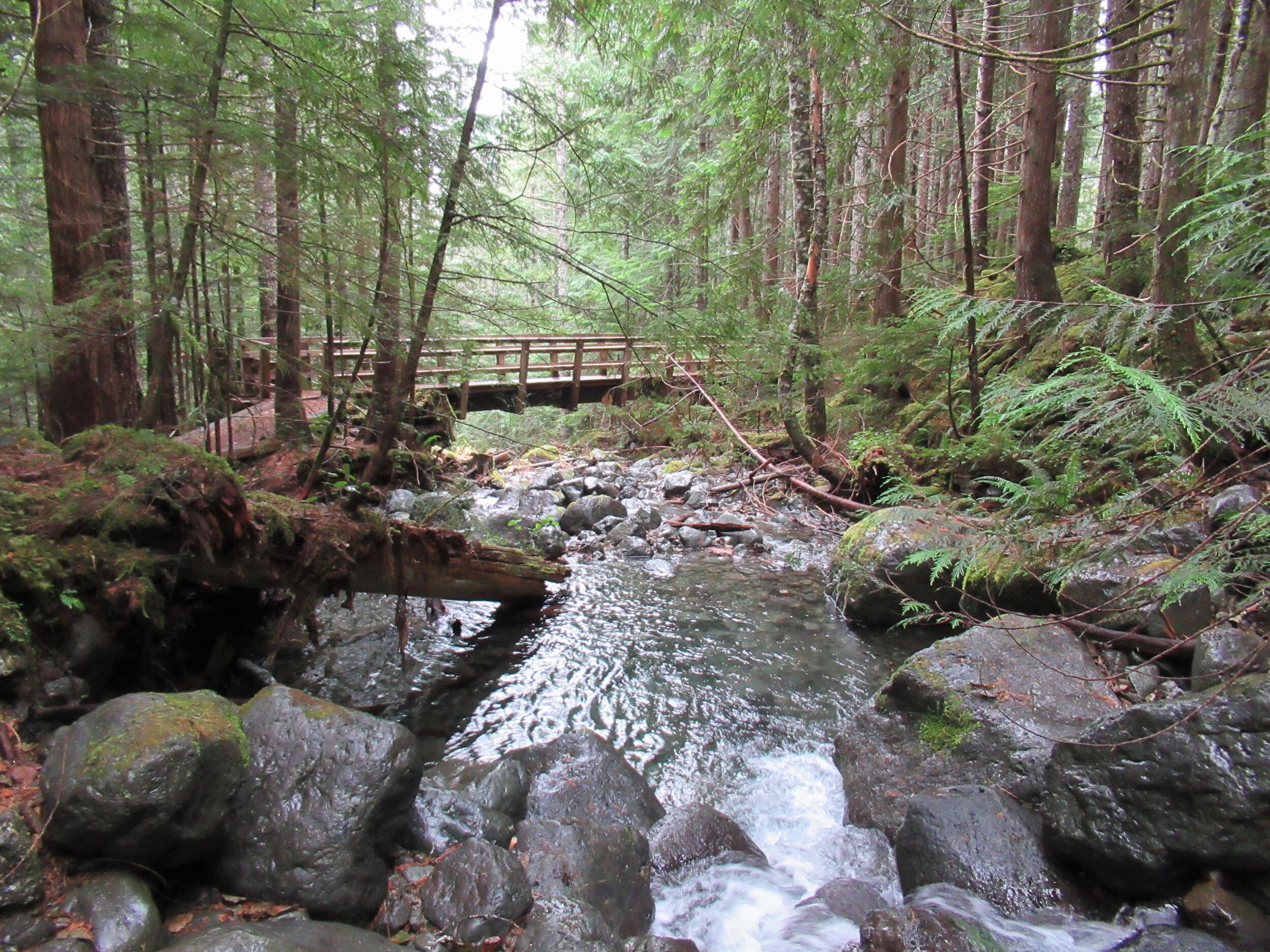
The 4.2 mile Big Creek Loop doesn’t go to a lake, high point, significant landmark or through groves of primeval forest. It just goes around the Big Creek basin crossing that banally named waterway and a handful of its tributaries. This hike is all about the journey—not the destination. The trail winds along forested slopes above Lake Cushman crossing tumbling creeks on a series of beautifully-constructed bridges.
" This hike is all about the journey—not the destination."
A couple of side trails branch off of the main loop to hidden cascades crashing among jumbled boulders. Hike this trail without an agenda—just set your mind free—and pause frequently to admire the show. Generally snow-free in the winter and with easy accessibility, Big Creek can be hiked year round.
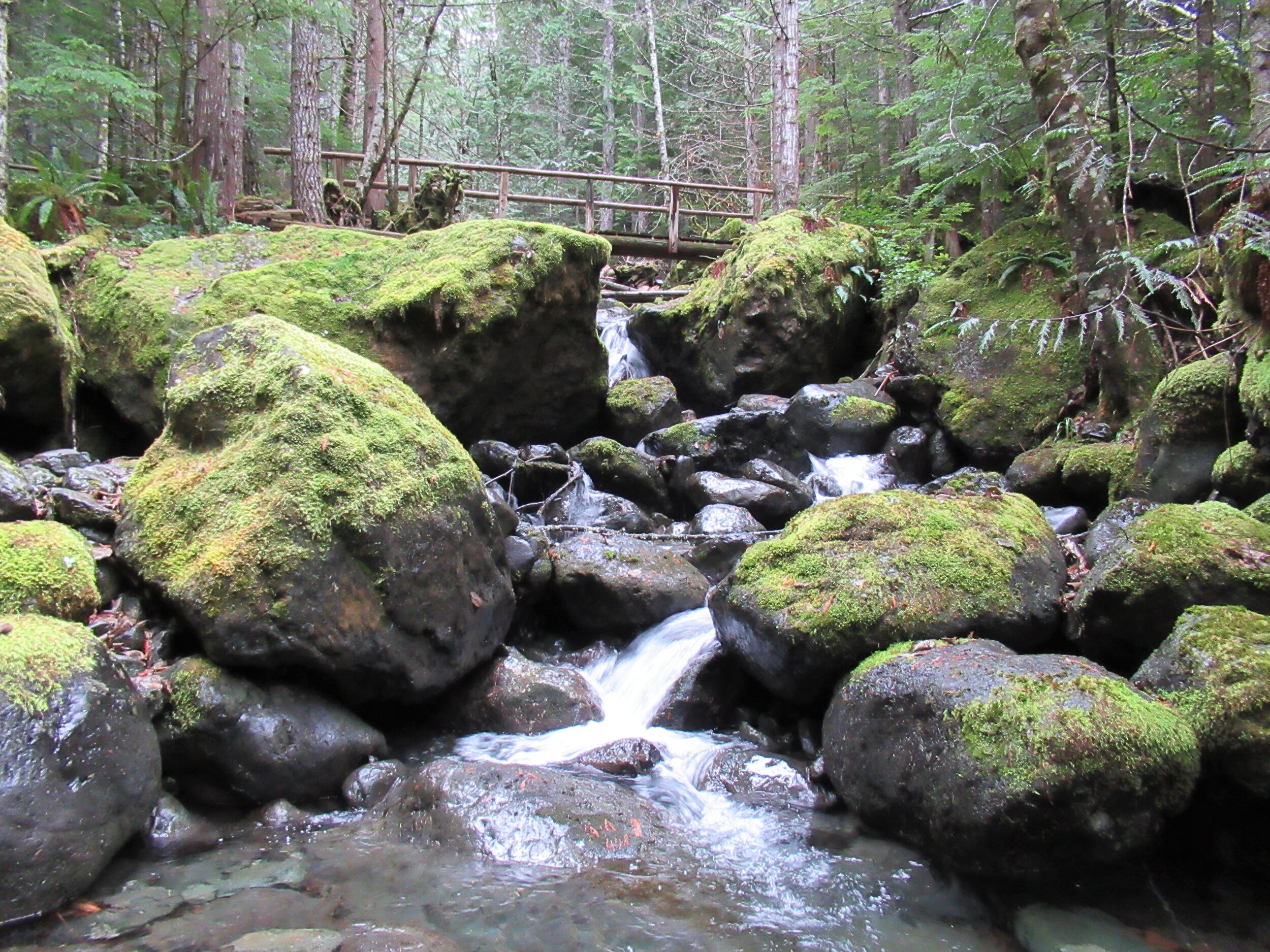
photo: Craig Romano
While it makes for a nice walk on a hot summer day with its shaded glens offering respite from midday rays—autumn through spring are best. Forested all the way, and always within earshot of tumbling water, the Big Creek Trail makes an excellent rainy day hike. Try to plan it after a period of prolonged rainfall for intense water shows that roar through the forest.

photo: Craig Romano
Utilizing old logging roads and newer tread, the all-volunteer Mount Rose Trail Crew built this delightful loop twenty year ago. “We have existed since 1985,” states Mount Rose Trail crewmember John Jurgens. The crew began as a group of Shelton area climbers who grew concerned over the increasing popularity of the old Mount Ellinor Trail. The old trail contained a section known as the “Chute” which was a hazardous rock and snow-filled gully. With the Forest Service’s blessing the crew constructed a new trail bypassing the chute allowing hikers a much safer passage on this popular trail.
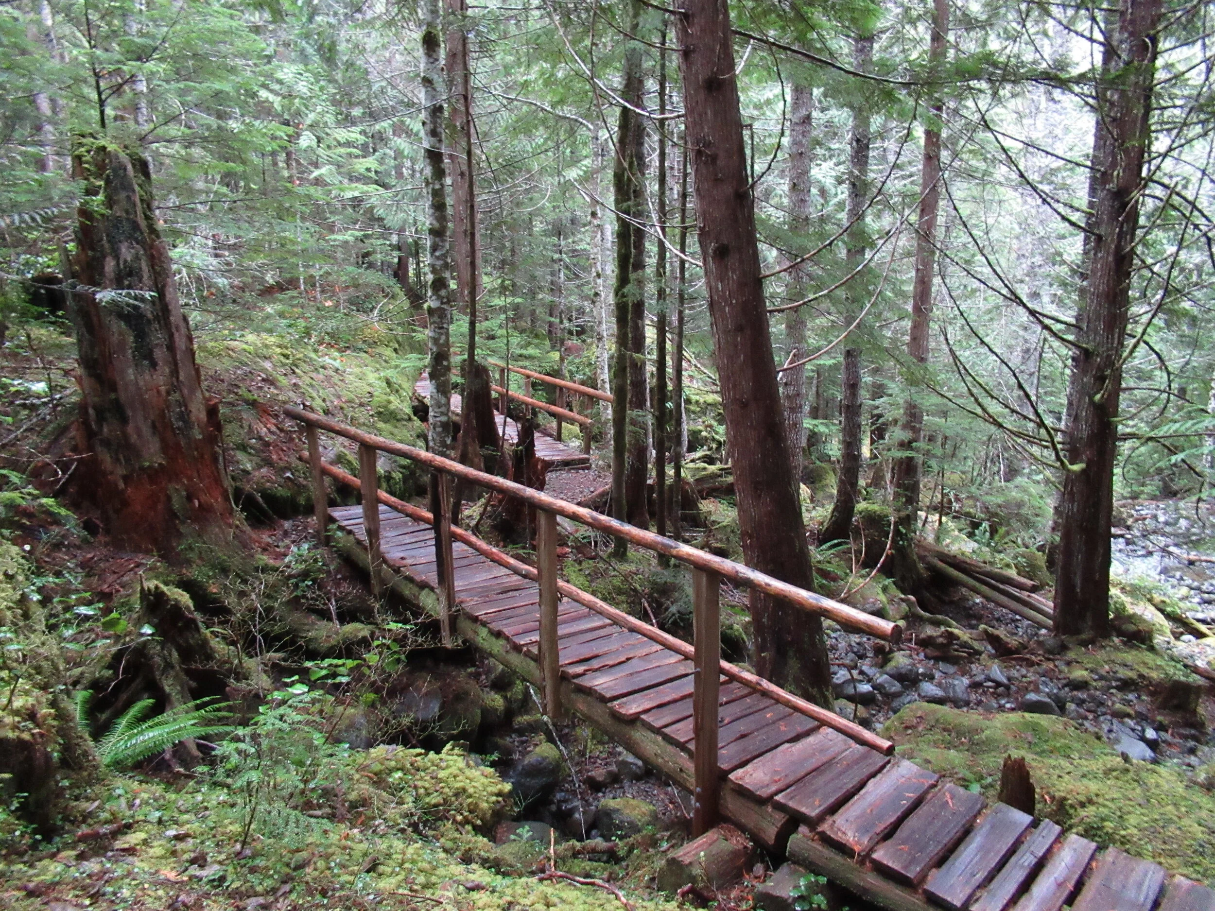
photo: Craig Romano
The crew took their name however from nearby Mount Rose. They worked on re-establishing the upper Mt Rose Trail when snow cover on Mount Ellinor didn’t permit them to work there.
From an original group of about 5, the crew now boast a half dozen members who hail from around the Hood Canal Region. They currently maintain 16 trails in the Olympic National Forest. The Big Creek Loop showcases their topnotch bridge building skills. Robust and built to last as Jurgens puts it, I find the bridges works of art that fit in well with their surrounding natural environment.
"The bridges for many hikers are the highlights of this hike. And children will find them especially appealing."
The trail starts from the recently rebuilt and expanded Big Creek Campground. Here follow what is officially called the Upper Big Creek Loop Trail. Most folks however just refer to it as the Big Creek Loop. The recommended direction is clockwise to take advantage of a gentler descent that will be easier on the knees. The trail immediately crosses Big Creek on a sturdy bridge—one of two provided by contractors and not the trail crew whom built bridges on site with area materials. You’ll immediately recognize the craftsmanship upon reaching them.

photo: Craig Romano
The trail briefly heads down stream along the creek before making a U-turn to begin ascending above it. Signed features and resting benches grace the way. After about a mile the grade gets steeper. Catch glimpses through gaps in the forest canopy of Mount Washington hovering above. At 1.8 miles you’ll come to a junction. You can take an interesting short side trip here on the Creek Confluence Trail which drops to the confluence of Big and Branch Creeks before looping back to the main trail. Here you’ll find good lunch rocks among the two tumbling waterways.
The Big Creek Loop continues straight coming to a junction with the Mount Ellinor Connector Trail just before reaching Branch Creek. The Connector Trail leads left 1.4 miles to the Mount Ellinor Trail and allows for a long and challenging ascent of that popular peak. If you’ve got some energy head one mile up it to a good viewpoint overlooking Lake Cushman,

photo: Craig Romano
The loop continues straight crossing Branch Creek on a good bridge. Just beyond it reaches Big Creek above a gorgeous cascade. Here a new well-constructed bridge spans the tumbling waterway.
The loop now begins descending, skirting some big mossy boulders and passing good views of roaring Big Creek. A short side trail—once part of the Creek Confluence Trail drops back down to where Big and Branch Creeks meet. The main trail now follows an old road, coming to bridged crossings of scenic Skinwood and No Name Creeks. Continue descending passing a few giant firs that loggers forgot. Notice the forest change here. The west half of the loop was dominated by hemlocks—while the eastern half is made up more of Douglas-firs and lodgepole pines. The understory is different too—cloaked here in salal.
Be sure to look up through the trees for a glimpse of Mount Ellinor rising above the watershed. At 4.0 miles come to a junction with the Campground Loop Trail which loops around the campground for 0.8 mile if you want to extend your hike. Otherwise continue right a short distance to return to the trailhead.
Notes:
Land Agency Contact: Olympic National Forest, Hood Canal Ranger District, Quilcene, (360) 765-2200; fs.usda.gov/olympic
Recommended Map: Green Trails Olympic Mountains East 168S
Guidebooks: Day Hiking Olympic Peninsula 2nd edition (Romano, Mountaineers Books)
Trailhead directions: From Shelton, travel north on US 101 for 15 miles to Hoodsport. Turn left onto SR 119, and proceed 9.3 miles west to a T intersection with FR 24. Turn left and then immediately turn right into the Big Creek Campground continuing a short distance to the Day Use Area and trailhead. When campground is closed, park at gate, but do not block it.
Trailhead facilities: privy, picnic area, campground, water.
Dogs welcome but must be leashed.